
📊 Full opportunity report: The Eye Over The City: How Wide-Area Motion Imagery Works — And Where It Goes Blind on ThorstenMeyerAI.com — validation score, market gap, and execution plan.
TL;DR
Wide-Area Motion Imagery (WAMI) captures entire cities in a single frame, enabling detailed tracking and forensic analysis. It is a key tool in military, border security, and disaster response, but has physical and weather-related limits. Its future lies in integration with radar technologies.
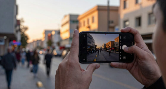
Wide-Area Motion Imagery (WAMI) is revolutionizing urban surveillance by enabling the capture of entire cityscapes in a single frame, tracking every vehicle and pedestrian in real time. This technology offers unmatched forensic capabilities, allowing analysts to rewind and analyze movements after an event, making it one of the most impactful surveillance tools of the last two decades.
WAMI systems, such as DARPA’s ARGUS-IS, use arrays of thousands of cameras to produce gigapixel images covering several square kilometers. These images are stabilized, processed, and archived for later analysis, allowing for detailed tracking of moving objects. The systems are mounted on aircraft, drones, and other platforms, providing persistent, day-and-night coverage of urban areas.
Since their development in the early 2000s, WAMI systems have evolved from experimental prototypes to widespread operational tools used by military, law enforcement, and civilian agencies. They assist in network discovery, border security, wildfire mapping, and disaster response, often complementing radar and other sensors.
Despite their strengths, WAMI systems face physical limitations: optical sensors are hindered by weather conditions like fog, smoke, and darkness, and require platforms to loiter overhead within physical reach. They are also bandwidth-intensive and expensive to operate, which constrains their deployment and real-time monitoring capabilities.
The eye over the city: how Wide-Area Motion Imagery works — and where it goes blind
A normal drone sees through a soda straw. WAMI watches an entire city at once, tracks every mover, and records it all for forensic rewind. Immense reach — with hard limits that make radar and AI its necessary partners.
- City-scale motion, fine detail
- Forensic rewind
- Cloud / smoke / dark degrade it
- Needs a platform loitering overhead
sensing
+ AI
- Sees through cloud & total dark
- Tasked over denied airspace
- Persistent, wide-area from orbit
- Sovereign · on-prem · air-gap
The same archive that traces a bomber to a safe house can trace anyone home — retroactively, without prior suspicion. Baltimore’s secret 2016 deployment led to a 2021 federal ruling that persistent aerial tracking violated the Fourth Amendment. The security value is real; so is the mass-surveillance risk. Who owns the sensor, the archive, and the AI is the accountability question.
WAMI’s power is the archive and the AI reading it; its weakness is weather, airspace, and oversight. The mature posture isn’t optical-vs-radar or capability-vs-liberty — it’s layered sensing (optical WAMI + all-weather SAR), AI-enabled exploitation, and sovereign, auditable control of the whole chain. WAMI shows what a persistent eye can do with clear skies and owned airspace; for the cloud, the night, and the denied area, the radar layer is where the resilient coverage lives.
Implications of WAMI for Urban Security and Surveillance
WAMI’s ability to monitor entire cities continuously enhances urban security, enabling rapid response to incidents and detailed forensic investigations. Its integration with other sensors, especially radar, promises a more resilient and comprehensive surveillance network. However, the technology raises privacy and governance concerns, as persistent, detailed monitoring of civilians becomes more feasible.

Hiseeu 3K PTZ Wired Security Camera System Outdoor with Audio
【360° Surveillance & Dual Control Security System】Flexibility 355° Pan + 90° Tilt Coverage – Eliminate blind spots with…
As an affiliate, we earn on qualifying purchases.
As an affiliate, we earn on qualifying purchases.
Evolution and Deployment of Wide-Area Motion Imagery
The roots of WAMI trace back to early 2000s programs like the Sonoma Persistent Surveillance at Lawrence Livermore National Laboratory. Transitioning to military use, systems like DARPA’s ARGUS-IS and the US Air Force’s Gorgon Stare have demonstrated the capacity to surveil large urban areas from aircraft and drones. These systems have expanded in scope and sophistication, becoming essential components of modern ISR (Intelligence, Surveillance, Reconnaissance).
Recent deployments include mapping wildfires, monitoring infrastructure after natural disasters, and border security operations. The technology continues to shrink in size and cost, increasing its proliferation across agencies and platforms.
While WAMI complements radar and other sensors, it cannot replace them entirely due to weather and platform constraints, which has led to ongoing research into sensor fusion techniques to overcome these limitations.
“WAMI provides a city-sized, forensic-quality view that was unimaginable a decade ago, transforming how authorities monitor and analyze urban movements.”
— Thorsten Meyer, expert on surveillance technology

DroneMobile XC-LTE 2K QHD 1440p 30fps Dash Cam with XC-RC1 Rear Camera – Ideal for Car Security and Surveillance
Enhanced security with dual stage shock sensor, glass-break sensor, and on-board alarm siren
As an affiliate, we earn on qualifying purchases.
As an affiliate, we earn on qualifying purchases.
Limitations and Challenges in WAMI Deployment
While WAMI systems are powerful, they are limited by weather conditions, the need for loitering platforms, and high operational costs. The extent of future integration with radar and AI-driven automation remains under development, and questions about data privacy and governance are still unresolved.
Google Nest Cam Outdoor (Wired, 2nd Gen) – Security Camera – 2025 – Snow
Meet the smarter, sharper wired Google Nest Cam Outdoor; with 2K HDR video and Gemini, it knows what…
As an affiliate, we earn on qualifying purchases.
As an affiliate, we earn on qualifying purchases.
Future Directions: Sensor Fusion and Governance Frameworks
Advances in AI are expected to improve real-time analysis and reduce reliance on human operators. Integration with synthetic aperture radar (SAR) will address weather and denial-of-service limitations, creating more resilient, multi-modal surveillance networks. Concurrently, policymakers are considering regulations to govern the use of persistent surveillance technologies.
TELUHA 4K Night Vision Goggles for Adults, 3.99" HD Screen, 10000mAh Rechargeable Night Vision Binoculars with 64GB TF Card for Hunting Camping Surveillance
Night Vision Goggles: Designed for reliable viewing in low-light and complete darkness, these night vision goggles feature infrared…
As an affiliate, we earn on qualifying purchases.
As an affiliate, we earn on qualifying purchases.
Key Questions
How does WAMI differ from traditional surveillance cameras?
WAMI captures a large, city-wide area in a single gigapixel image, allowing for continuous, forensic-level tracking of multiple moving objects simultaneously, unlike traditional cameras which focus on narrow fields of view.
What are the main limitations of WAMI technology?
WAMI is limited by weather conditions such as fog and smoke, requires platforms to loiter overhead, and involves high operational costs. It cannot see through clouds or darkness without additional sensors like infrared or radar.
How is WAMI being integrated with other sensors?
Researchers are developing sensor fusion techniques to combine optical WAMI with synthetic aperture radar (SAR), enabling all-weather, day-and-night coverage and addressing each other’s blind spots.
What are the privacy concerns related to WAMI?
Persistent, high-resolution surveillance raises significant privacy issues, especially regarding civilian monitoring, which is prompting discussions about regulations and oversight frameworks.
What is the future of WAMI technology?
Future developments include AI-driven automation for real-time analysis, expanded sensor integration, and stricter governance policies to balance security benefits with privacy rights.
Source: ThorstenMeyerAI.com